Tag: walking holidays

Story of the week: Remote trekking in Turkey

SANYO DIGITAL CAMERA

* Heading back in the archives this week for a story of remote trekking and welcoming home stays in Turkey.

As ever, follow me on Twitter, or subscribe to the RSS, for weekly updates from my travel-writing archive in the months to come.

I’ve got a theory about visiting new places: two feet are best.

The best way to learn about local culture and meet local people is to tackle a walking trail.

So while city slickers were stroking their chins ponderously over art installations in Istanbul, last year’s European Capital of Culture, I chose a trekking trip to a rural backwater to connect with the traditional Turkish culture.

Blazing a trail

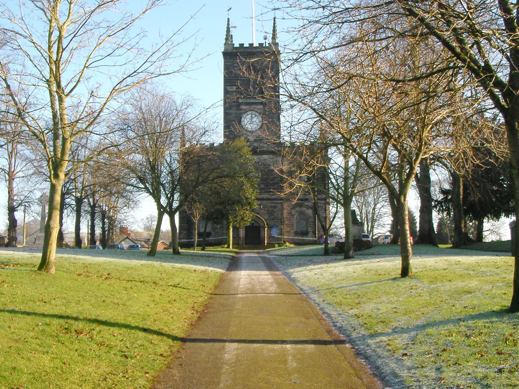
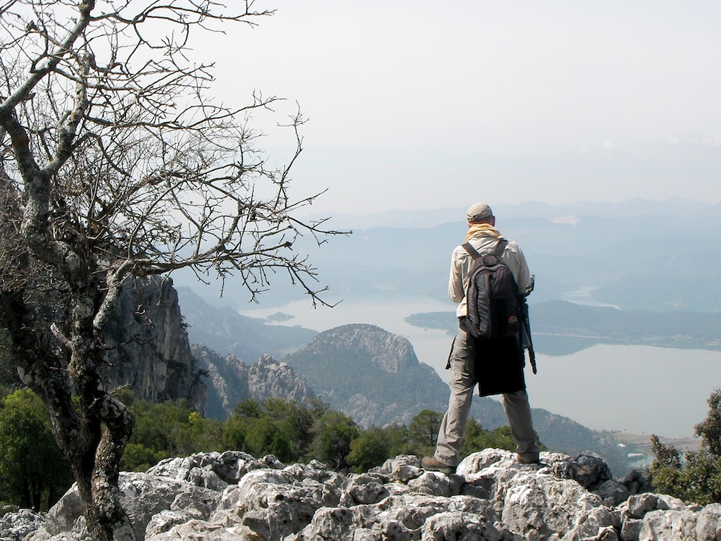
The St Paul Trail [pictured above], a three-section, long-distance footpath between Aspendos (or Perge) near Antalya in the south and Yalvac in central Turkey, is the country’s newest walking – a total of 500km, or 24-day, of serious trekking.

I say new. It was established around 2005, but is still very much in its infancy in terms of local infrastructure and visitor numbers. Some sections are remote and physically demanding.

A volunteer team of waymarkers marked out the trail last summer to encourage visitors and bring much-needed tourism revenue to the remote village communities.

I opted to walk a week of day sections along the more popular southeastern leg, running 120km south from Adada to Aspendos, transferring from trailheads each evening to local accommodation.

While independent travel is possible, my trip was booked through a local tour agency and included jeep transfers, a walking guide and accommodation in simple but friendly homestays along the way.

I join the trail amongst the Roman ruins of Adada, where the fragments of the settlement are blissfully lost in time. As I clamber over the ruined pillars, I am alone, silent amongst the ghosts of an ancient civilisation.

The path down to the village of Sagrak is the first truly iconic stretch of the trail, following the old Roman road through a rocky scrubland of gorse bushes and wild garlicky chives.

I spend the afternoon descending over huge Roman slabs to arrive at the tranquil village in time for the afternoon call to prayer and my first saccharine hit of sweat Turkish tea, served up by a group of old men from the mosque.

We sit in the courtyard, all smiles and gestures, before a jeep ride to the Kasimlar for the night.

Home sweat home

The house of Abdul Kokdogan and his wife, Serpil, is one of the best-established homestays on the southeastern section of the trail.

It’s also a benchmark for how the burgeoning infrastructure of the St. Paul Trail could develop over the years to come.

Most importantly, the well-connected family has obtained the only alcohol licence in what is a deeply conservative rural community, ensuring a sturdy kitchen cupboard is always kept well stocked with bottles of local, very drinkable Efes Pilsner for new-arrival walkers.

I bed down that night on a fold-down sofa in the living room with lots of thick blankets for those chilly village nights.

A breakfast of bread, cheese and homemade jam, washed down with glasses of strong, sweat tea, is served the next morning in the same room, while a wood-burning stove provides a cosy glow.

“We’ve made friends around the world,” smiles Abdul over breakfast.

“We learn about their culture and my wife shows them how to make Turkish bread or goats’ cheese.”

As I prepare to leave, the morning call to prayer echoes off the mountains, neighbours call by to chat and their spiky-haired teenage son animatedly describes his hopes for an influx of good-looking female travellers on the new trail.

I drain my tea, shake hands with the family and prepare to hit the trail. “I’ll be back to see how the route develops,” I promise.

Their smiles are genuine, not forced.

Remote access

The next day walk from Kasimlar to Kesme starts from the village graveyard and climbs moderately to the Belsarnig Pass, where the old Roman well marks the summit.

The going is good and I weave in and out of the waymarked path to dip under the shade of pine trees for water breaks. The snow-capped peak of Tota mountain soars above the climbing path, while larks, cuckoo and nightingales encourage me onwards.

As I approach the pass, moving into greener pasture, a herd of hungry cows offer a nonchalant greeting. I can hear the cries of a local shepherd in distance.

He’s telling us, explains my guide Deniz, he knows we’re coming and will try to keep his wolf-like dog under control. “Just remember,” warns Deniz, suddenly serious.

“Don’t get between the dog and the goats. Not ever.”

We transfer on from Kesme at dusk, avoiding a night of camping in favour of another family-run pension on trail at Caltepe.

I’ve got a long day ahead, heading south on the trail back towards Antalya but the warmth of the welcome by Erdinc Barca at his simple but atmospheric guesthouse instantly puts me at ease.

We sit on the terrace, picking out the stars over the mountains and sipping sugar-thick tea as Erdinc offers his advice for tomorrow’s walk.

A breakfast of fruit, bread and honey sets me on my way at dawn, following another old Roman road past chameleon rock formations and dipping into the shade of olive trees en route. The landscape on this leg had a more ethereal, twilight atmosphere with mossy, volcanic rock-carved grottos.

Heading home

The final leg takes me south via the Roman bridge over the Kaprulu Canyon to the well-preserved ruins of Aspendos and the dusty, sun-baked southeastern trailhead at the nearby aqueduct.

Strolling through the well preserved ruins makes for a suitably atmospheric end to the hike but after the freeze-frame pace of village life, the transition back to the real world is an uneasy one.

A women waves a 5€ note for a camel ride, a local man rubs his hands behind a counter covered with tepid cans of soft drink and the jobsworth ticket officer grumbles about me taking pictures.

I had to fight a mad urge to turn on my heels and start walking again, exploring another section of the trail, or embarking on one of the more ambitious sections.

After all, there was plenty more trail to explore.

* This story was first published in RedHanded Magazine in 2011. Liked this? Try Hiking Remote Trails in Turkey.

Post your comments below.

Story of the week: A pilgrimage trail through the British Midlands


SANYO DIGITAL CAMERA

* Another story from the archive this week, an autumnal walking piece with a pilgrimage theme.

Follow me on Twitter or subscribe to the RSS for more story updates. 

Werburgh looks down serenely from the east window of Chester Cathedral’s Refectory.

The room is a chaos of school groups, small children and international visitors, all tucking into Welsh rarebit and baked potatoes. But Chester’s Patron Saint, her hand grasping the staff of an abbess and a model of the monastery founded on this site in the other, is the epitome of saintly calm.

The elaborate stained-glass window, based on the writings of the monk Henry Bradshaw at the Abbey of St Werburgh in 1513, celebrates her saintly life and eternal connection to Chester.

Werburgh, known as St Werburga in Old English, may be less famous than St Cuthbert or St Aidan, but she remains a constant calming presence in Roman city of Chester.

This month her presence will be felt her even more keenly. The Cathedral will celebrate her feast day on February 3 with a special service, while the journey of Werburgh from a noble Staffordshire family to sainthood provides the narrative backdrop to the Two Saints Way, a newly opened long-distance walking trail through the rural heart of England.

Walk the trail in the winter months to have the sun behind you and catch the best views.

Walking trail

The trail divides into four sections over, typically, seven days and recreates the ancient pilgrimage route between Lichfield and Chester Cathedrals via Stafford and Stoke-on-Trent.

The trail’s name refers to St Werburgh and St Chad, two Saxon saints who brought Christianity to the ancient kingdom of Mercia (the modern-day Midlands) in the 7th century. The saints were laid to rest at Chester and Lichfield respectively, their relics fuelling the rise of medieval pilgrimage routes across the British Isles onto Rome or Jerusalem.

Some followers went on pilgrimage to seek spiritual healing as miracles were reported to have happened in the places where the saints were buried – Chester claims two, whereby parading her bones around the city walls saved the city from disaster.

Others were dispatched to atone for their sins. Indeed, church records from the village of Tarvin, just outside Chester, show some sinners were sent on the pilgrimage to Lichfield for the crime of fornification.

The heyday of pilgrimage declined with the Act of Supremacy in 1534, installing Henry VIII as head of the Church of England, but these trails are increasingly popular again today with latter-day pilgrims seeking spiritual connections on a long-distance hike.

“The pilgrimage has become a contemporary quest for ancient wisdom. It encapsulates what life is about, namely going on a journey,” says David Pott, who devised the Two Saints Way and is walking with me on the trail.

“In the contemporary context, it’s about asking questions and seeking answers. But modern pilgrims seek to do so in mind, body and soul.”

Country paths

I set out to explore a section of the trail closely associated with Werburgh, making my base at the medieval pilgrimage town of Stone in rural Staffordshire.

The nine-mile day walk leads from just south of Stone to the Trentham Estate near Stoke-on-Trent. Pilgrims can also walk the 88-mile route as a complete linear trail from Lichfield to Chester, the path waymarked with the symbol of the goose, a reference to one of Werburgh’s miracles.

There are less written of Werburgh’s journey and fewer tangible sites linked to her than Chad. The main source of reference is a document written by the Flemish monk Goscelin in Canterbury in the late 10th century.

However, ecclesiastical records do record something of her life. Werburgh, the daughter of the Mercian King Wulphere, attracted many admirers but devoted herself to God. She defied her father’s command to marry and instead entered the Abbey of Ely, falling to her knees upon arrival to remove her regal garments and exchange them for the nun’s habit.

Werburgh went on to found convents in Northamptonshire, Staffordshire and Lincolnshire. She was buried at Hanbury, but her body was later moved to Chester.

On a bright but crisp winter morning, I join the trail at the village of Burston, some 30 miles north of Lichfield. My path hugs the Trent and Mersey Canal for the first couple of miles, skirting the village millpond and the old pilgrimage church of St Rufin.

I then follow a public footpath beside a gurgling brook towards Stone, crossing a Wildlife Trust site alive with birdlife and occasional sightings of otters.

The trail leads down the High Street in Stone, past iron railings recounting the story of Wulphere, to Stone Priory and the church of St Mary and St Wulfad [pictured above], the latter one of Werburgh two brothers martyred by their own father. The original Augustinian Priory on the site on the site dates from the 12th century while the present Gothic-style church was built in 1758.

Victorian stained glass windows on the north aisle depict Chad, Werburgh and her brothers. The seal of Stone Priory was found in a field in 2011 and returned to Stone later that same year. The 13th-century copper-cast seal depicts St Mary with, some suggest, St Wulfad, sat beside her.

During the next section, leaving Stone for the village of Tittensor, recorded in the Doomsday Book of 1086 as Titesovere, and then onto Trentham, the trail opens up to reveal more open farmland and woodland.

Tucked behind a wooded hill is Bury Bank, an ancient hill fort formerly known as Wulphercestre (Wulphere’s camp), probably the capital of the ancient kingdom of Mercia. This site is believed to be Werburgh’s birthplace, while Saxon’s Lowe, just beyond the fields along a path known as Nun’s Way, is an Iron Age burial place.

Wulphere is believed to have chosen this ancient site as his burial place before his death in 675AD.

I complete the day’s walking, traversing the 300-year-old woodland of the Trentham Estate, to finish with a moment of contemplation at St Mary’s Church, Trentham. The praying stone, lying before a Saxon cross in the churchyard, has been smoothed over during centuries by the knees of travellers gathered in prayer.

Cathedral quarter

The next day in Chester, having skipped over a section through rural Cheshire, Nick Fry, Heritage, Visitors and Exhibition Manager at Chester Cathedral, is showing me around the cathedral’s signposts to the Werburgh story.

We start at the Quire, the place where the monks would pray, and identify the misericord, one of Chester Cathedral’s little known treasures. The carved seat for monks is engraved with scenes from Werburgh’s life. “It’s like a medieval cartoon strip dating from 1380,” smiles Nick.

The Cathedral has been a place of pilgrimage since 907AD when the first stone church was built in Chester to hold Werburgh’s relics. Her effigy still fills the cathedral today, the St Werburgh Pilgrimage Trail leading from the Refectory via the Quire to the Lady Chapel, home to the shrine of St Werburgh.

After a life of religious devotion, Werburgh died around 700 and her body was moved to Chester from Hanbury in 875 to protect it from waves of Viking raiders attacking England. The cult of Werburgh survived centuries of conquests and, in the 14th century, an elaborate shrine was built in her honour with 34 carved figures and a number of niches where pilgrims could kneel in prayer before the saint.

Henry VIII commanded the shrine be broken into fragments during the dissolution of the monasteries in the 16th century and it wasn’t until 1876 that A.W. Blomfield, charged with restoring Chester Cathedral, collected the fragments. The Lady Chapel is today a popular place for pilgrimage and prayer at the cathedral.

Nick says, as we stand before the shrine, contemplating a small carved effigy of Werburgh below where the casket of her relics would have been stored:

 “Pilgrims still come here as they did in the Middle Ages. They still want that feeling of wholeness, both physical and spiritual.”

In medieval times, pilgrims believed in the healing power of the saints and the way their powers infused the stone of the shrine, hence they wanted to get as close to her, and pray to her, for as long as possible. There would have been scenes of jostling. These so-called squeezing spaces, where pilgrims would bask in her presence, are still visible around the base of the shrine.

“We still sometimes find little posies of flowers around the base,” says Nick as the presence of the ancient saint engulfs us. “Werburgh is a calming influence,” nods Nick.

“There’s something about being here that just brings a sense of quiet to us all.”

 * This story was first published in Discover Britain magazine in 2012. Liked this? Try Pilgrimage Trails on the Llyn Peninsula.

And post your comments below.

Story of the week: Pilgrimage Trails on the Llyn Peninsula


DSCN1543

* Last week a small pub on a beach in North Wales was named the third best beach bar in the world, beating bars in Australia, America and South Africa. I’ve visited the Ty Coch Inn [pictured above] several times and this story was based around my first encounter with a Llyn Peninsula institution.

I’m not cut out for life as a pilgrim.

Mortification of the flesh is not my thing and, besides, I don’t have anything in sackcloth.

Windswept on a fresh Saturday morning at St Beuno’s Church in Clynnog Fawr, however, I found myself about to retrace the footsteps of the 20,000 saints that blazed a medieval trail to Bardsey Island during the 14th-century halcyon days of the North Wales pilgrimage.

Tackling the 47-mile Edge of Wales walk, an extension to the Llyn Coastal Path, could help me find some higher meaning to life. Or, at least, shed a few pounds, get some sun and soak the scenery in this lost-in-time enclave of rural North Wales.

When the Pope decreed that three pilgrimages to Bardsey would have the same value as one to Rome, the Llyn Peninsula witnessed a pilgrim explosion and Bardsey became the Mecca.

But while the original God-fearing wanderers set out with just cloaks and sandals, the present-day pilgrims beside me at St Beuno’s assembly point had come armed with GPS and Gore-Tex jackets.

“By following the pilgrim’s way I feel at one with nature and God,” explains Gill Gordon of a group of third-order Franciscans.

Walking country

The four-year-old trail splits into nine convenient stages across four to five days and visits the ancient forts, holy wells and medieval churches that waymarked the original pilgrim’s trail.

Overall, the Llyn makes for perfect walking country with plenty of infrastructure, plus deserted beaches, wild flower-shrouded headlands and rustic, lost-in-time villages to discover en route.

Better still, while the beaches and guesthouses of the hub towns, Abersoch and Aberdaron, are packed in summer, come autumn the Gulf Steam-warmed climate and empty, open spaces make for an ideal time to visit.

Over the next few days the going would range from strenuous on the first sections, a 13-mile yomp, often uphill, from Clynnog to Nant Gwrtheyrn, to gloriously flat on the middle straight from Nefyn to Tudweiliog that dips its toes into the waves that lap the National trust-owned beach.

The scenery was ever changing – from crashing rocks and Atlantic swells as I hugged the north coast, to ruined Methodist churches and rustic farmsteads on occasional inland deviations.

The sense of being close to the saints was always with me, especially at the humble little church of Pistyll.

Many pilgrims were sick and ill, their odyssey the last act of a dying soul, and Pistyll church became a regular stop as the garden was given over to growing herbs and plants to help treat the sick.

As I open the thick-set wooden door of the church, I’m transported back in time by the herbal smell of the interior: rushes on the floor, flower garlands across the pews and the heady aroma of evergreens filling the air.

Perfect pub

The Llyn Peninsula is proudly Welsh and the population 80 per cent Welsh speaking, yet people are happy to chat with a passing pilgrim at the rural pubs along the route.

Tracing the headland to the beach at Porth Dinllaen [pictured below] for a late lunch one day, I found one of my favourites, Ty Coch. From its beachside location, Ty Coch has been attracting a new genre of pilgrim of late: film buffs.

Demi Moore shot key scenes from the 2006 Hollywood drama, Half Light, in the pub, but her tinseltown trappings did little to impress the locals.

“She had a helicopter to take her back to the hotel just to use the toilet,” laughs the pub’s co-owner Stuart Webley. “Talk about spending a penny.”

The days passed with ozone-filled strolls and glorious coastal vistas while Edge of Wales guides were on hand at the end of the day to transport me onto a comfortable B&B for the night and a full Welsh breakfast the next morning.

Peninsula parish

So it was with a heavy heart that, as I descended the hill to face the imposing brick façade of St Hywyn’s church, Aberdaron, I knew the end was nigh.

The Welsh poet RS Thomas made Aberdaron his parish from 1967 to 1978 and his bleak, angry verse captures the end-of-the-world feel of the village.

Across from the church, restaurant Y Gegin Fawr was built around 1300 for saints to claim a meal before heading to Bardsey and today remains a café, although lasagne now replaces gruel.

According to Evelyn Davies, the current vicar of St Hywyn’s, some 120,000 latter-day pilgrims enquire each year about retracing the Bardsey pilgrimage. “It’s not just a physical journey,” she nods, looking at my well-worn boots, “most are on an inner journey.”

Island life

Tossed about in a small, canary-yellow boat in the Aberdaron Sound, I finally arrive on Bardsey to a welcoming committee of seabirds: Manx Shearwater and puffins.

As I stride ashore amid the perfect still of the afternoon, the ghostly cry of the grey seals evokes the wailing and gnashing of teeth of the 20,000 martyrs that died on the island as saints, their souls cleared of sin and a one-way ticket to eternal paradise assured.

I follow the dirt track to the ruins of the eight-century St Mary’s Abbey and kneel before the weather-scared Celtic cross. Ignoring my aching feet and a sudden craving for chocolate biscuits, I focus on the words on the inscription:

“Respect the remains of 20,000 saints buried near this spot.”

My pilgrimage was complete but the journey was just beginning.

This story was first published in Coast magazine in 2009.

Liked this? Try also, Wales Coast Path blog for Visit Wales.

Your view? Post your comments below.

DSCN1545

Story of the week: Walking the Wales Coast Path

DSCN1521

This is the latest post in a weekly series, highlighting stories from my travel-writing archive. Subscribe to the RSS feed for more. This week’s piece is particularly timely as last Sunday marked the first anniversary of the opening. Want to read more? Try Wales Coast Path blog for Visit Wales.

The landscape opens up in widescreen, all crashing waves and wide-open skies.

I feel a frisson of vertigo as I peer over the sheer cliff drop but steady my gaze on the path ahead, the promise of wooded glades and secluded beaches luring me onwards. I fill my lungs with fresh air and close my eyes, emptying my mind and tuning into the rhythms of nature instead.

Better still, I’m the only walker on the trail today.

I’m walking a section of the new Wales Coast Path, the new 870-mile trail from the Welsh border near Chester to Chepstow in the southeast. It connects existing coast paths, such as Anglesey and Pembrokeshire, to form one continuous circuit – making it the very first coast path to outline an entire country.

Along the way it showcases the best of Welsh landscape and wildlife. Think near-deserted coastal trails, wave-lapped scenery and a natural habitat rich with flora and fauna.

I’ve chosen a walk along the Glamorgan Heritage Coast, a 14-mile section from Porthcawl to Aberthaw, as a microcosm of the entire path. It’s also the nearest section of the path to air hub, Cardiff.

For me, walking the Glamorgan coast was the perfect way to discover one of the lesser-known regions and uncover some warm Welsh hospitality. The Glamorgan coastal path skirts the Bristol Channel with views of ruined Ogmore Castle to the north and south to Exmoor.

“I love the contrasts of this walk. You look across to Devon, not a blank horizon of sea,” says Principal Ranger Paul Dunn. “You can almost touch it on a clear day.”

I had started walking just beyond Porthcawl, first tackling the sand dunes of Merthyr Mawr before progressing onto the salt marsh of the Ogmore estuary. Numerous flower species, including the rare Tuberous Thistle, line the trail and the twice-repeated refrain of a song thrush serenade my steady progress.

I stop for tea and a chance to read up on local geology at the Heritage Coast Information Centre at sheltered Southerndown Bay.

This sweep of South Wales may be sandwiched between the industrial hubs of Port Talbot and Barry, but it’s the last ice age that forged the landscape of rocky outcrops, built on layers of Carboniferous limestone.

It lends the coast an otherworldly feel captured by the TV series Doctor Who, which renamed Southerndown as Bad Wolf Bay for a season-ending climax staring David Tenant.

The path then climbs up from the beach through the former deer park of the Dunraven Estate, following a new public footpath to increase access. After ducking through a maritime-ash woodland, I take a detour at Nash Point, heading inland for lunch at the Plough and Harrow in the village of Monknash.

Back on the coast path, Nash Point Lighthouse was the last manned lighthouse in Wales. The twin lighthouse keepers’ cottages have now been converted into self-catering accommodation with the ultimate sunset vista.

I push on, low-slung afternoon sun softening the landscape, tracing a line along the coast past Tresilian Bay and Summerhouse Point to the trailhead just before Aberthaw.

St Donat’s Arts Centre, an old tithe barn just off the path in the village of Llantwit Major, is staging a performance of Welsh jazz that evening, but I’m heading back to Olivia House, a stylish but homely guesthouse in Porthcawl, for a long soak and a chance to rest weary feet.

After a day on the trail of fresh air, stunning views and escaping the crowds, I’ve got a tasting of walking Wales.

Just another 856 miles to go.

This story was first published in BA High Life magazine in 2012. Read the original piece here

Have you got a favourite section of the Wales Coast Path to walk?

Post your comments below.